Five Data Points You Should Know Before Buying Farmland
Five Data Points You Should Know Before Buying Farmland
LR WheatHarvest
LR WheatHarvest
Searching for farmland can be made far simpler with accessible, accurate land data. Land data can help you identify properties with characteristics that suit your individual needs, weed out less desirable properties, and help you ask the right questions when evaluating a new parcel so you can be confident about your purchase.
This article will cover five important data points that you should consider when evaluating potential properties.
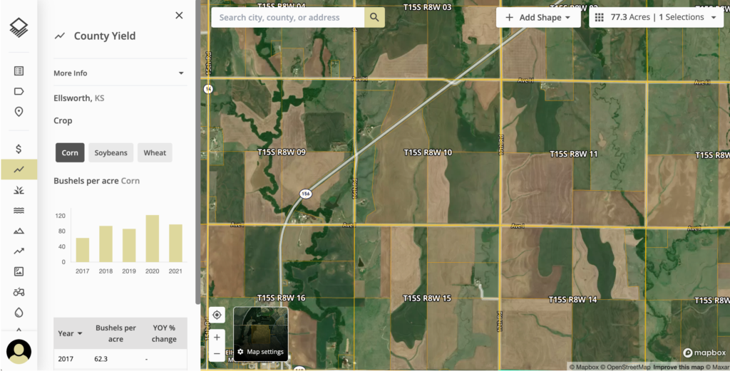
County Yield
Crop yield is a data point that measures the amount of crops produced on a single farm. County yield is an average measurement of crops produced on all of the land zoned as farmland in one specific county.
Identifying the county yield for multiple counties is one method of narrowing your search for the right farm. While you may expect neighboring counties to have similar average crop yields, varying topography, shifts in soil quality, and access to irrigation or rainfall may vary drastically from one farm to the next.
The USDA utilizes farmer-reported surveys to track county yield data for annual, year over year crop yields. While analyzing this data is an integral step in searching for farmland, individual properties may have different yields and this number is only a rough guide.
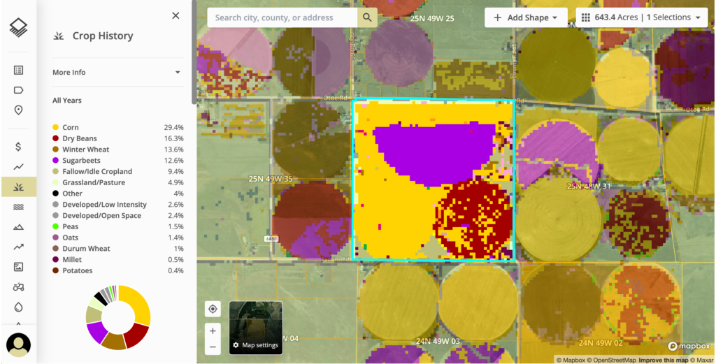
Historical Land Use
The USDA compiles crop coverage and growing season images gathered via satellites for a comprehensive analysis of the different uses and management practices that agricultural land has had year over year.
This layer may uncover potential issues that are less obvious when visiting a property and can help you ask the right questions about historic land management. Additionally, understanding the crop optionality in a specific region can help you determine which crops can feasibly be grown and rotated on any particular parcel of farmland.
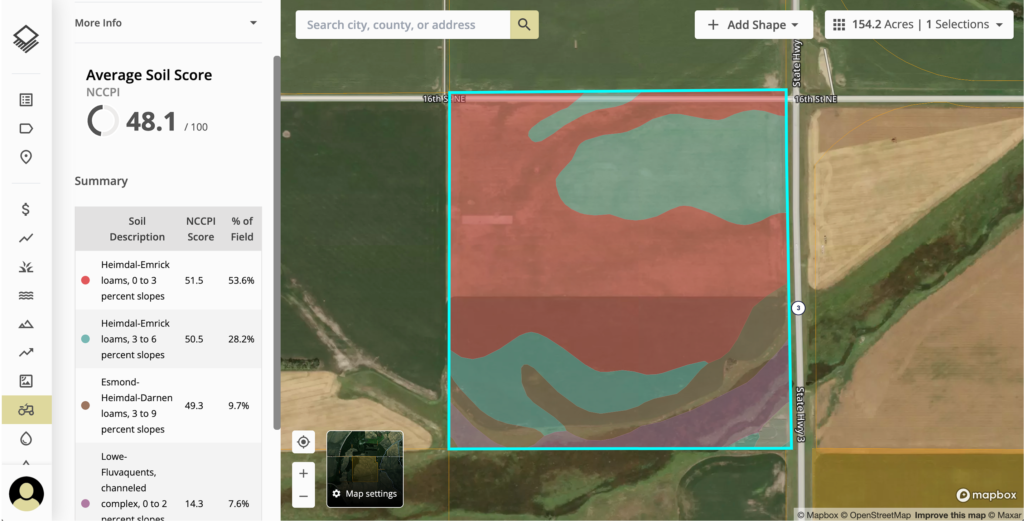
Soil Data
Access to soil data is another pivotal consideration for buyers looking for farmland. Soil scores can be indicative of yield averages and crop options.
The Natural Resources Conservation Service compiles soil survey data that helps buyers analyze soil composition and quality. For states lacking a specific productivity index, NCCPI (National Commodity Crop Productivity Index) is used. Some states, like Indiana or North Dakota, also have their own soil productivity indexes based on regional factors.
Understanding whether the soil type on a particular farm is consistent across the property and appropriate for growing your desired crop-types is important in securing a property suitable for your farming practices.
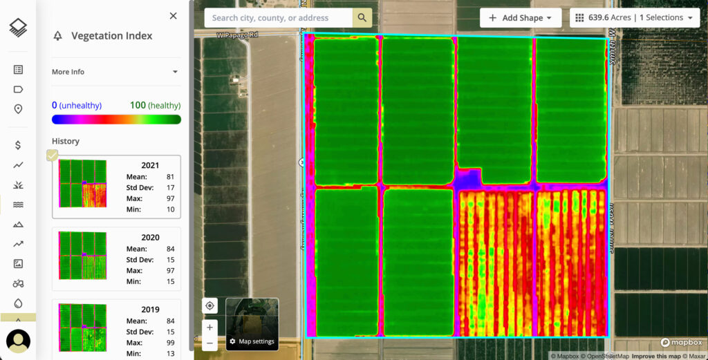
Vegetation Index
Another data layer to consider is the vegetation index on any particular property. The NDVI (Normalized Difference Vegetation Index) uses light wave reflections to indicate a plant’s health. Aside from locating healthy crops with this data, it also may suggest problem areas where the crops are not flourishing.
Viewing this information year over year with satellite imagery may help illuminate issues with topography, soil fertility, or other potential growing inhibitors.
Flood Zones
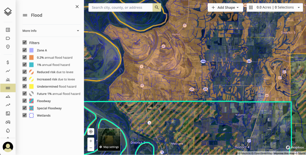
FEMA (the Federal Emergency Management Agency) provides regularly updated flood maps to help communities identify flood risk in their area. This information is also useful when considering farmland.
Without doing your due diligence, flood zones can be an unpleasant surprise in the future that may not only negatively impact your property value but also pose productivity and crop planning risks.
Final Thoughts
These data points are helpful tools that buyers can use to evaluate potential farmland. However, accessing this basic information about individual parcels is often time-consuming and requires extensive due diligence.
Acres, a comprehensive land analysis tool, speeds up the process by putting this information and more at your fingertips. With Acres, you can efficiently access 10+ layers of insights for over 150 million U.S. parcels, save and share data, customize maps, and view comparable sales all in one place. You can create a free account today at Acres.co.


